Project Leads: Anat Caspi & Nick Bolten – CSE, CEE, Taskar Center
Data Scientist Leads: Vaughn Iverson (primary) and Bryna Hazelton (secondary)
DSSG Fellows: Thomas Disley, Meg Drouhard, Jessica Hamilton & Kaicheng Tan
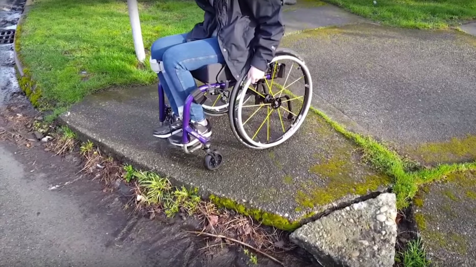
Project Goals: This project aimed to fill a gap we’ve identified in the availability of open data related to pedestrian walk ways and the physical environment. While Open Street Maps (OSM) is one of the most successful crowdsourcing data projects out there, all data related to pedestrian walk ways are represented as attributes of automobile roadways. This has great implications for the ability to utilize the data for pedestrian routing (wayfinding), as well as the utility of the data in rural and low-resource environments, and other environments where automobile routes are dissociated from pedestrian ways (for instance, Venice, Italy).
The purpose of this project is (a) to advance the application of automated wayfinding to enhance accessible pedestrian travel for people with disabilities and (b) to improve opportunities for crowdsourcing information about the built environment (e.g., pedestrian and foot paths, bus stops, street furniture, delightful trees, etc) that would feed into a travel chain that meets the diverse needs of travelers with mobility, vision, hearing and cognitive disabilities and provides them the ability to plan and execute an on-demand trip anytime of the day and from any location.
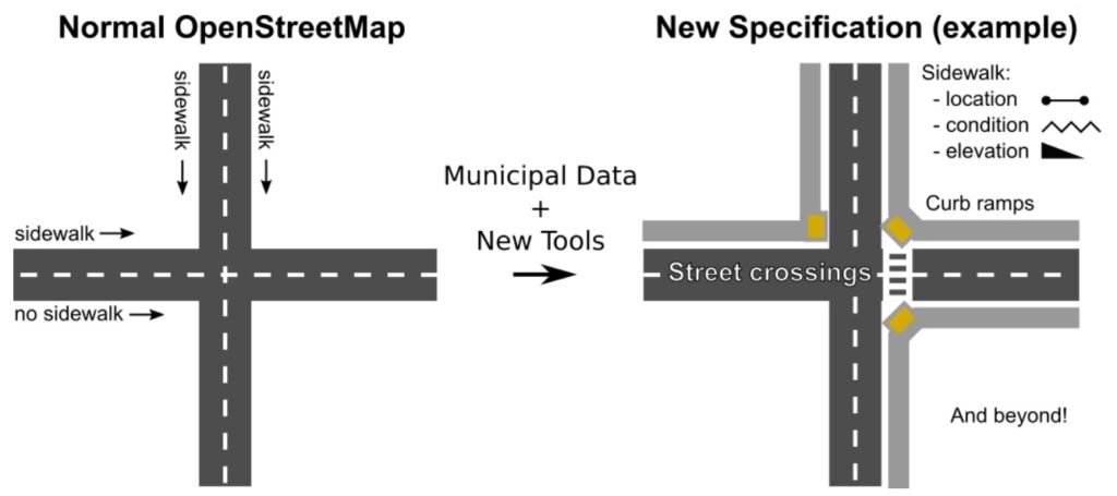
Project Outcomes: We engaged in the development of a separate data layer contributed to Open Street Maps (OSM) and delivered a proposal to the OSM organization regarding recommended procedures, schema requirements, and a prototype that demonstrated the manner in which populating the data layer would improve wayfinding applications for target groups and stakeholders. We delivered the proposal at the ‘State of the Map, U.S. meeting’ which took place in July 2016. One of the outcomes of this work was the identification of mobile app solution that could enhance and improve data collection and data validation for footpaths and pedestrian ways, including data that is transient in nature. Our prototype and proposal emphasizes principles of open and inclusive information exchange.
Project webpage: https://opensidewalks.com/