By Robin Brooks
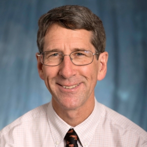
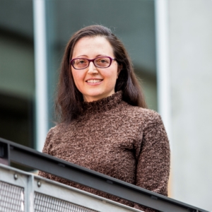
A collaboration between two eScience Institute Data Science for Social Good (DSSG) project leads has resulted in a financial award which allows them to continue their work. Mark Hallenbeck, director of the Washington State Transportation Center, and Anat Caspi, director of the Taskar Center for Accessible Technology, both eScience fellows, answered questions submitted by Robin Brooks, communications associate, by email for this piece.
Brooks: Congratulations on receiving $250,000 in funding from the Washington State Department of Transportation! When did you find out about the award, and can you please explain what it will be used for?

Hallenback: The end of November was when we knew that the award would be granted. The contract is currently being signed by OSP [Office of Sponsored Programs], but the award letter has been received from the Washington State Department of Transportation. The project has two major objectives, the first is to jump start the deployment of the route-able sidewalk layer data that the OpenSidewalks project, led by Dr. Caspi and [PhD student] Nick Bolten, has deployed for downtown Seattle. Being able to actually understand how well pedestrians can move around a city (i.e., where they can and cannot walk easily) has major implications for how transportation plans are developed, and how effective new transit services will be.
Thus, the second objective of the project is to demonstrate how the sidewalk layer data, when connected to the ORCA [One Regional Card for All] transit use data, can be used to greatly improve our ability to analyze and model the benefits of different non-motorized infrastructure improvements. We will use the current availability of sidewalks to help explore the importance of sidewalks to explain why people choose to use or not use transit. We will then modify some existing tools to take advantage of the new sidewalk layers. Finally we will test the use of those new tools by examining where improvements to the existing sidewalk infrastructure are likely to have the greatest impacts on people’s willingness to walk to transit.
Brooks: How did this project come about?
Hallenbeck: This project came about as a result of the DSSG. Anat and I met as a result of her DSSG project from two summer’s ago, and the two DSSG projects we did this past summer (where she was Co-lead on the ORCA project, but also Co-leading the Sidewalk project.) While working on the ORCA project this past summer, I learned more about OpenSidewalks. The emphasis with that project was on the need for route-able sidewalk GIS layers to help route people with disabilities and to help demonstrate to the transportation planners of the region, the need for prioritizing specific sidewalk and other access improvements.

Caspi: While the OpenSidewalk project is motivated by the informational needs of people with disabilities, it is clear that a pedestrian-centered sidewalk layer had many broad applications including walking/biking advocacy, safe routes to school, urban planning and the ability to provide routes that are customized to people’s individual needs. However, in order to offer this as a sustainable repository for these kinds of projects that consume the OpenSidewalk data, we definitely need the support and buy-in from agencies like WSDOT. Mark proposed a number of ideas to help broaden WSDOT’s support for the sidewalk layer data. Together we pitched a number of ideas to the local agencies. This particular project met a number of needs for WSDOT, so they agreed to fund it.
Brooks: Could you tell us who’s on your team?
Hallenbeck: The team has a number of DSSG alumni. Dr. Caspi and I will lead the effort. We have two DSSG alumni from this past summer (Miki Verma and Nick Bolten), and one from last summer (Rohan Aras.) We will also be adding another graduate student Mayuree Binjolkar, and an undergraduate, Bingbing Huang.
Brooks: What are you trying to accomplish or discover?
Hallenbeck: As noted above, there are three major goals, 1) to greatly expand the availability of route-able sidewalk layer data, 2) to demonstrate the planning benefits of having access to that type of data, and 3) to demonstrate how tools based on that data can be used to evaluate and prioritize non-motorized infrastructure improvements.
Brooks: How did your work at the eScience Institute impact the project?
Hallenbeck: DSSG is how the participants first connected. Working together and talking frequently allowed us to both understand what was possible, and understand how what is possible fits with what funding agencies were most interested in, and thus willing to fund.
Brooks: How long will the project take and when will you start?
Caspi: The funding starts in January 2017 and lasts for nine months. However, the Taskar Center is committed to sustaining work on the OpenSidewalks project, specifically in the provisioning of tools for the community to support a rout-able sidewalk layer.
Brooks: Are there any additional comments that you’d like to make?
Caspi: I would love to see urban mappers as well as bicycle- and pedestrian- advocates adopting our pedestrian-centered mapping approach.
Hallenbeck: Nothing other than I’m looking forward to submitting another DSSG application for this coming summer.
Brooks: Thanks so much for taking the time to answer these questions!

