Project Lead: Mira Berdahl, UW Earth and Space Sciences
Data Science Lead: Scott Henderson
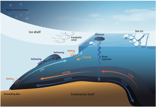
Modern Antarctic ice loss is largely driven by warm, dense circumpolar deep water (CDW), which reaches the ice sheet margin and causes ice to melt. Antarctic mass loss has significant implications for global sea level rise, but the mechanisms that transport CDW to the ice sheet remain poorly understood. This is because observations are sparse, and most global climate models lack the spatial resolution to accurately represent the complex atmosphere-ocean processes at play. High-resolution global simulations now provide an opportunity to accurately represent critical features such as CDW transport. This research aims to leverage an unprecedented set of high-resolution global climate simulations to decode the drivers of CDW transport and assess improvements in climate model accuracy.
The large data volumes from these high-resolution global simulations (1TB per variable per run) require novel parallel computing and thoughtful workflow and visualization strategies. We are utilizing a combination of open-source Python software tools including Xarray and Dask-jobqueue which permit dynamic scaling to thousands of available CPU nodes in order to run computationally intensive algorithms such as computing decadal 3D climatological means for different variables of interest (e.g. temperature). We plan to make our workflows publicly available, such that other scientists working with the latest version of simulations can more rapidly glean insight from these important datasets.
Preliminary analyses already show distinct differences in the high-resolution Southern Ocean subsurface temperatures compared to low-resolution runs. These subsurface temperature differences have major implications for ice sheet health.

