
Project Lead: Sangmin Song, Oceanography
Data Science Lead: Scott Henderson
The ocean holds a massive 93% of the world’s carbon that cycles among the atmosphere, land, and sea. Because of its capacity to absorb vast amounts of human-emitted carbon from the atmosphere each year, the ocean has effectively buffered society’s impact on climate over the past century. However, the current and future extent of this capacity are not certain. As carbon continues to accumulate in our atmosphere, quantifying the marine response will be critical for monitoring and adapting to a changing climate. A remarkable ~40% of global oceanic carbon uptake is attributed to one region: the Southern Ocean. Comprising the waters encircling Antarctica, the Southern Ocean has been especially challenging to characterize by traditional shipboard sampling due to its remote location and harsh conditions. Excitingly, over the last twenty years, a growing international fleet of drifting oceanic robots called Argo floats has revolutionized our ability to observe the ocean interior at a global scale. These remotely operating instruments (which UW helps to develop and deploy) have enabled impactful studies in previously inaccessible regions, including the Southern Ocean.
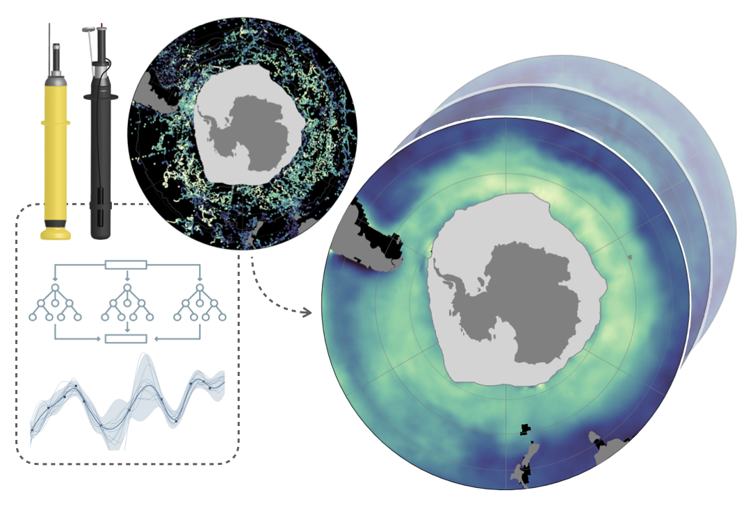
Our project presents a new approach to mapping where and when carbon flows intensely between the Southern Ocean and the atmosphere; this framework combines the advantages of unprecedented observational coverage from Argo floats with those offered by modern data science techniques. Since all Argo floats measure ocean temperature and salinity but relatively few are equipped to measure carbon, we train a suite of machine learning algorithms to estimate surface carbon using more widely available measurements from floats as well as ships, satellites, and other environmental products. The application of our regression model, CRUSOE*, expands the number of relevant carbon data points (2014–2023) available in the Southern Ocean by 20-fold. Using this dataset, we then derive a novel ten-year record of ocean carbon maps, which represents a key missing piece for better quantification of Southern Ocean carbon uptake. Such improvements in the Southern Ocean will ultimately be essential for understanding the global carbon cycle.